Best Hill Stations to Visit
1.Matheran
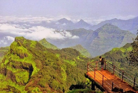
Matheran is a hill station and a municipal council in Karjat Tahsilin the Raigad district in the Indian state of Maharashtra. The smallest hill station in India, it is located on the Western Ghats range at an elevation of around 800 m (2,625 feet) above sea level. It is about 90 km from Mumbai, and 120 km from Pune. Matheran's proximity to many metropolitan cities makes it a popular weekend getaway for urban residents. Matheran, which means "forest on the forehead" (of the mountains) is an eco-sensitive region, declared by the Ministry of Environment, Forest and Climate Change, Government of India. It is Asia's only automobile-free hill station.
- Mumbai to Matheran : 90 km
- Nashik to Matheran : 174 km
- Matheran to Khandala : 68 km
- Matheran to Lonavala : 69 km
- Matheran to Lavasa : 174 km
- Matheran to Mahabaleshwar : 219 km
2.Khandala
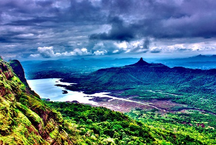
Khandala is a hill station in the Western Ghats in the state of Maharashtra, India, about 3 kilometres (1.9 mi) from Lonavala and 7 kilometres (4.3 mi) from Karjat.Khandala is located at one (top) end the Bhor Ghat, a major ghat (meaning valley in Marathi) on the road link between the Deccan Plateau and the Konkan plain. The ghat carries an extensive amount[clarification needed] of road and rail traffic. Due to the ease of accessibility from nearby cities, Khandala is a common area for hiking.The route near Khandala sunset point and khopoli has been there since centuries used to connect the coastal cities like Sopara to Pune. The transport from base of khopoli was by carts both hand pulled and horse drawn, which was tarred during British time somewhere in 1840.
- Mumbai to Khandala : 92 km
- Nashik to Khandala : 230 km
- Khandala to Matheran : 68 km
- Khandala to Lonavala : 14 km
- Khandala to Lavasa : 119 km
- Khandala to Mahabaleshwar : 195 km
3.Lonavala
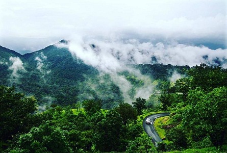
Lonavla and the adjacent Khandala are twin hill stations 622 metres (2,041 ft) above sea level, in the Sahyadri ranges that demarcate the Deccan Plateau and the Konkan coast. The hill stations sprawl over an approximate area of 38 square kilometres (15 sq mi). Tourism peaks during the monsoon season. The name Lonavla is derived from the Sanskrit lonavli, which refers to the many caves like Karla Caves, Bhaja Caves and Bedsa that are close to Lonavla. A trip to Lonavla and Khandala can be combined with sight-seeing visits of Karla, Bhaja and Bedsa caves and also the two fortresses, Lohagad and Visapur. Another place of interest is the Tungi fort, one of the forts captured by Malik Ahmad near the village of Karjat and was known for its natural strength.The Andharban trek begins from village Pimpri, passses through dense forests, valleys and waterfalls and ends in Bhira.
- Mumbai to Lonavala : 92 km
- Nashik to Lonavala : 231 km
- Lonavala to Matheran : 69 km
- Loanvala to Khandala : 14 km
- Lonavala to Lavasa : 115 km
- Lonavala to Mahabaleshwar : 191 km
4.Lavasa
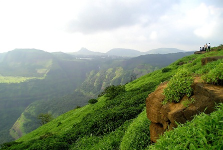
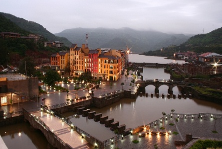
Lavasa is a private, planned city being built near Pune.It is stylistically based on the Italian town Portofino, with a street and several buildings bearing the name of that town.A 25,000 acres (100 km2) or 8,000 acres (32 km2) project being developed by HCC, this as-yet-incomplete city has been controversial for multiple reasons including procurement of land, harm to the environment, and loans acquired through political corruption.In late 2010, the Indian Environment and Forests Ministry ordered that construction cease because the project violated environmental laws.As of late 2011, this order has been rescinded.
- Mumbai to Lavasa : 197 km
- Nashik to Lavasa : 273 km
- Lavasa to Matheran : 174 km
- Lavasa to Lonavala : 115 km
- Lavasa to Khandala : 119 km
- Lavasa to Mahabaleshwar : 176 km
5.Mahabaleshwar
Mahabaleshwar is a hill station in India's forested Western Ghats range, south of Mumbai. It features several elevated viewing points, such as Arthur’s Seat. West of here is centuries-old Pratapgad Fort, perched atop a mountain spur. East, Lingmala Waterfall tumbles off a sheer cliff. Colorful boats dot Venna Lake, while 5 rivers meet at Panch Ganga Temple to the north.Located about 120 km (75 mi) southwest of Pune and 285 km (177 mi) from Mumbai, Mahabaleshwar is a vast plateau measuring 150 km2 (58 sq mi), bound by valleys on all sides. It reaches a height of 1,439 m (4,721 ft) at its highest peak above sea level, known as Wilson/Sunrise Point.Climate of the area is suitable for cultivation of strawberries, Mahabaleshwar strawberry contributes to about 85 percent of the total strawberry production in the country.It also received the geographical indication (GI) tag in 2010.
- Mumbai to Mahabaleshwar : 273 km
- Nashik to Mahabaleshwar : 348 km
- Mahabaleshwar to Matheran : 219 km
- Mahabaleshwar to Lonavala : 191 km
- Mahabaleshwar to Lavasa : 176 km
- Mahabaleshwar to Khandala : 195 km
